You ask, I answer.
with geographic intelligence.
Glaide geographically connects your asset data and enriches it with an abundance of surrounding data sources. That's how Glaide makes the complex world queryable — in plain language. Our intelligent engines answer your questions clearly, with deep intelligence.
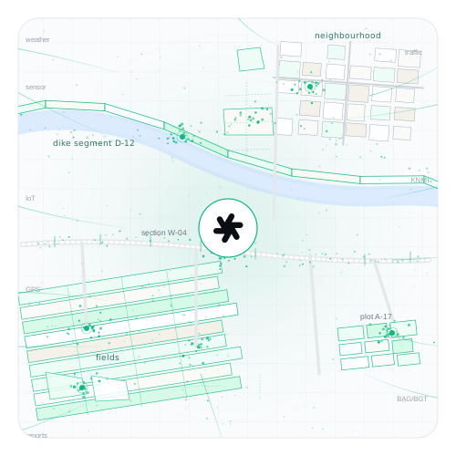
Asset data is everywhere. But fragmented.
Every department, sensor or vendor keeps its own source. Nobody sees the whole picture.
Integrations are a bottomless pit.
Connecting, normalising, maintaining. Every new initiative starts from scratch.
AI stumbles on unconnected data.
Without shared context, smart models can't give smart answers.
Geometry as the backbone. Everything hung onto it.
One geographic foundation where every source clicks in. The result: context AI understands and can use straight away.
All sources come in
Open data, closed sources, sensors, PDFs, legacy asset systems — we take it all in and clean it up.

Geometry connects it all
Road sections, fields, neighbourhoods, dike segments. Every data source gets its geographic place and clicks onto the right geometry.
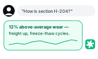
AI answers in plain language
Select an area, ask your question. Glaide combines data, context and reasoning, and delivers a tailored answer.
From raw data to decision-ready insight.
Six concrete benefits you'll feel from day one — for your team and your stakeholders.
From fragmented to connected
All asset and sensor data on one map. One shared reality, finally, for the whole team.
Questions in plain language
No SQL, no BI training. Type the question you'd otherwise ask a colleague. Glaide does the rest.
Goodbye, integration hell
A new source? It slots in through our pipelines. You analyse, we keep the plumbing alive.
Domain-agnostic
Roads, dikes, neighbourhoods, fields, croplands — the same approach. One platform for your entire asset portfolio.
AI-ready out of the box
Glaide feeds any LLM or agent with rich geometric context. The value sits in the connection — and it's already there.
Scales from plot to region
Start with one plot or section. Scale to an entire region without breaking your data model.
One platform, every domain.
Whether you run infrastructure, manage water, work the land or steward the public realm — Glaide speaks your language.

Infrastructure & transport

Water authorities

Agriculture

Public realm
Select. Ask. See the answer.
A real fragment from a Glaide session. No building dashboards, no running reports — just ask and move on.

Bring your asset data to life.
Let us show you in 30 minutes what Glaide does with your geometry and sources — on your own data.